New two-volume Cartobibliography of the Netherlands
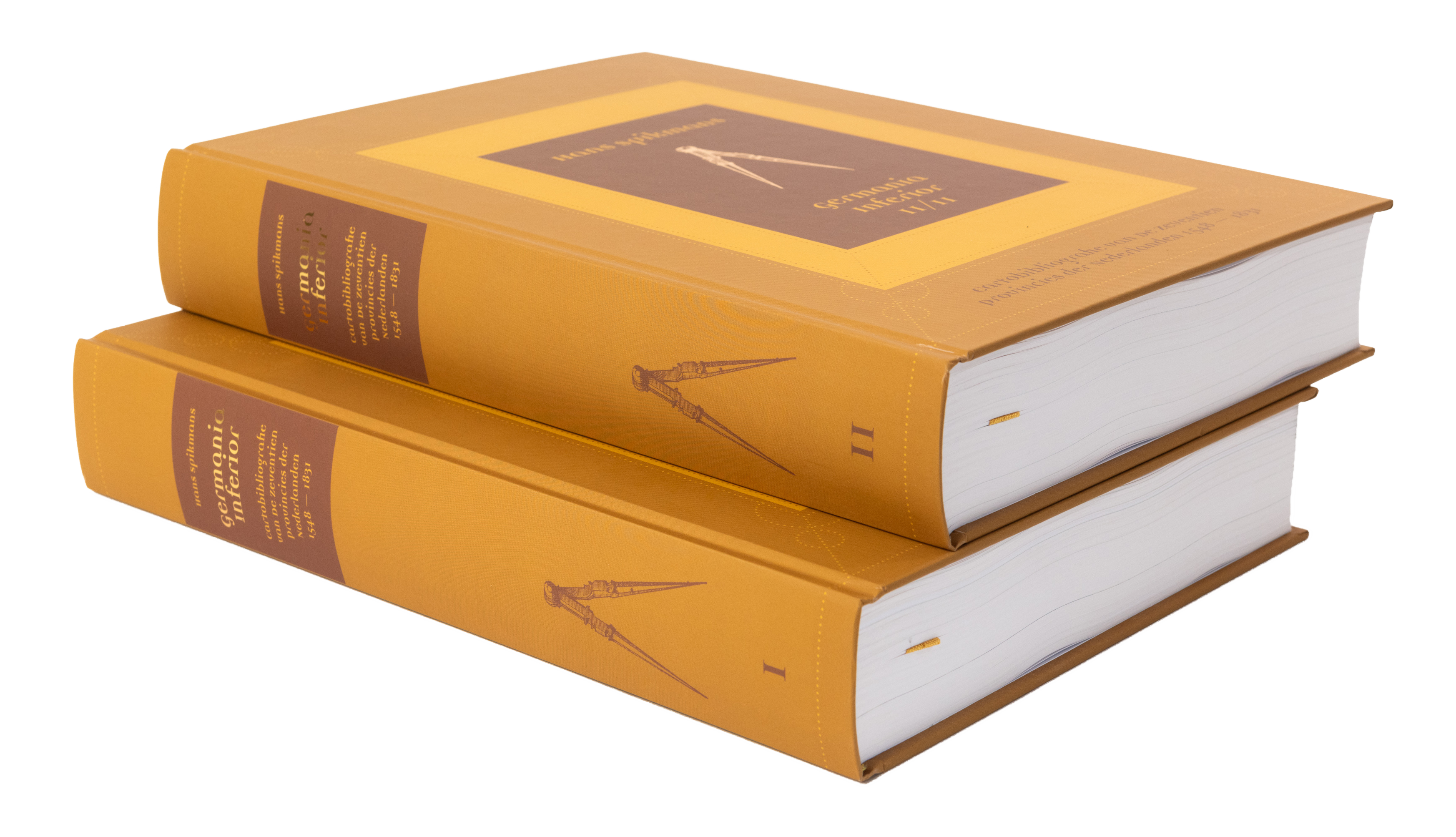
Germania Inferior – Cartobibliografie van De Zeventien Provincies der Nederlanden 1548 – 1831
Second print-run due to overwhelming success and high demand!
Revised edition, 2 volumes, each 1096 pages, with:
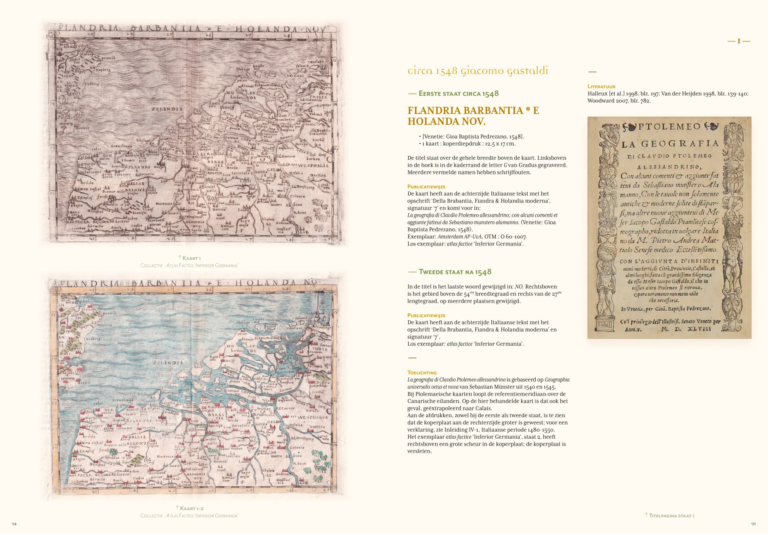
410 historical maps of the Netherlands;
80 newly discovered maps;
Featuring: 200 new states (adjustments) of previously described old maps;
Including: descriptions of books and atlases with maps of the Netherlands.
Price: €279.50 per set, excluding handling & shipping.
The most interesting period in the history of the Netherlands, Belgium and Luxembourg was the time of the Eighty Years’ War, of the subsequent economic and cultural boom, and of the decline of the Netherlands at the end of the 17th century.
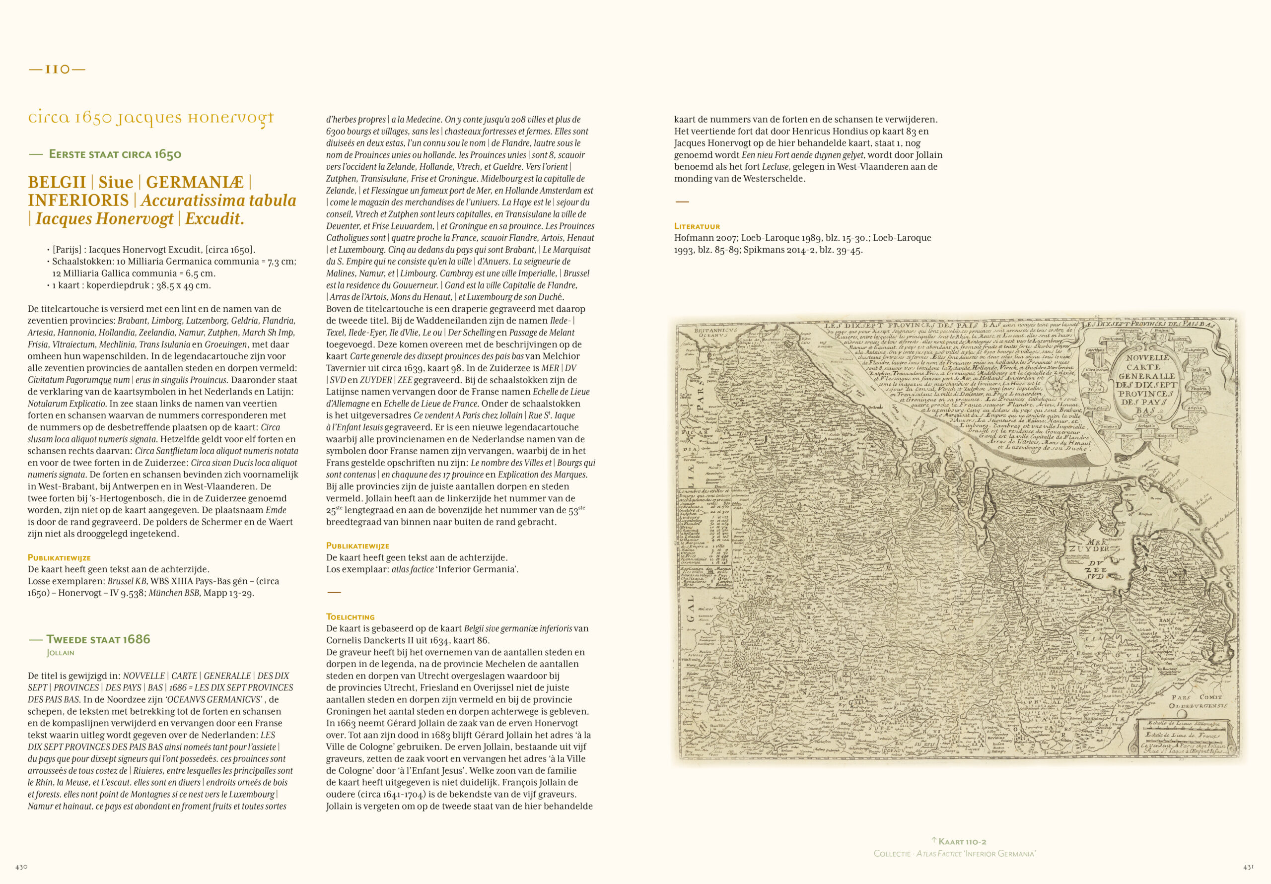
Compiler, author and publisher – Hans Spikmans: “This time span, with its Burgundian and Habsburg periods, has produced very instructive wall maps and folio maps, many in color and illustrated with detailed beautiful cartouches. This cartography also found a market elsewhere in Europe.”
The new cartobibliography Germania Inferior describes four periods of the Low Countries: the origins (1363-1543); the unitary state (1544-1579); the separation of North and South (1580-1648); and the developments up to 1800 and beyond.
The civil, administrative and economic conditions of each period are briefly and clearly outlined, as are the political and military developments. Together they provide the necessary backgrounds of the aesthetic, technical and commercial advances in the field of cartography.
The cartography of that time is extensively illuminated in Germania Inferior. Cartographers, engravers and publishers, all sorts of collaborations, and their international professional lives (beyond the boundaries of their maps), all receive consideration. The books also show how the mapping technique is spreading, and how many copper engravings eventually change hands and are given a new life, whether or not adapted to new circumstances. Sometimes the original creator gets all the credits, but plagiarism is common, too. Cartography becomes an art form, not only to enrich books, but also to brighten up interior walls.
Also featuring: a separate chapter on the cartographic developments up to 1800 and beyond in France, from the earliest period to the emergence of the Dutch contribution, and to the independence of French cartography.
- Second print-run due to overwhelming success and high demand!
- Revised edition, 2 volumes, together 1096 pages
- Exceptionally beautiful printed in full colour FM grid, large
- format hardcover: 230 x 320 mm – 460 x 320 open
- Seam-bound, fitted with reading ribbons, soft touch cover, printed with gold foil embossing
Including: English foreword, explanatory notes and introduction.

Price: €279.50 per set, excluding handling & shipping.
Acquired by leading libraries
Bayerische Staatsbibliothek München; Bibliotheek Rijksdienst voor het Cultureel Erfgoed Amersfoort; Bibliothek Deutsches Historisches Museum Berlin; Bibliothèque Fondation Custodia Paris; Bibliothèque Nationale de Luxembourg; Bibliothèque Nationale de Paris; Germanisches National Museum Nürnberg; Hendrik Conscience Erfgoedbibliotheek Antwerpen; Koninklijke Bibliotheek Brussel; Koninklijke Bibliotheek Den Haag; National Library of Finland Helsinki; Rijksmuseum Amsterdam; Staatliche Bibliothek Regensburg; Staatsbibliothek zu Berlin; Universitätsbibliothek Heidelberg; Universitätsbibliothek Münster; Universitätsbibliothek Zürich; Universiteitsbibliotheek Antwerpen; Universiteitsbibliotheek Gent; Universiteitsbibliotheek Groningen; Universiteitsbibliotheek Utrecht; Universiteitsbibliotheek UvA Amsterdam; Universiteitsbibliotheek VU Amsterdam; University Library Bodleian Oxford; University Library Cambridge.
Readers about Germania Inferior
Het review over het boek Germania Inferior in het wetenschappelijk cartografisch tijdschrift ‘Imago Mundi’ uit juni 2026 zegt: “Het boek vormt een welkome en actuele update van de bibliografie van de Lage Landen”.
– Caroline De Candt, The Brussels Map Circle
Great appreciation for the countless hours you devoted to the creation of “Germania Inferior”. This is truly a magnum opus, and your publication deserves wide recognition in the world of institutions, enthusiasts, collectors and researchers of cartographic material.
– Collector
My compliments for this comprehensive work, which will undoubtedly be the new standard work on the maps of the XVII provinces. There has apparently been much to discover after the two-volume edition by H.A.M. van de Heijden. Enough for many hours of reading and study pleasure.
– Collector
You have truly given birth to a phenomenal tome with your “Germania Inferior”! An achievement of stature, you have planted a milestone in cartographic bibliography.
The quality and design – the cover, the refined typography and fonts, the graphic design and beautiful photography, in color, really everything to perfection, it is both tactile and visual a feast.
The contents: Well, you put it into words yourself; 80 new maps and 200 unknown states, what more could a map enthusiast or collector want! The necessary research that preceded this can be guessed at.
– Collector